June 08, 2026
Haute-Maurienne
Current Risk Summary
Low avalanche risk.
Updated 4 months ago
Danger Rating
Level 1
Low risk
Elevation
All Elevations
Low risk
Affected Aspects
Highlighted directions indicate noted slopes.
Avalanche Triggers
Skier Triggered Avalanches
wet snow under skis.
Natural Avalanches
small isolated releases in recent snow that is warming up during the day.
Tomorrow's Trend
June 09, 2026
Forecasted Risk
Level 1
Low risk
→ Stable (Level 1)
Forecast Details
Low avalanche risk
Fairly good nighttime refreeze. Superficial warming during the day.
Snow Stability
### LAST BULLETIN OF THE SEASON
Typical Avalanche Situation
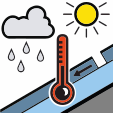
Wet Snow / Rain / Temperature Problem
Warming or rain weakens the snowpack, leading to wet-snow avalanches.
LAST BULLETIN OF THE SEASON
- Natural avalanches: Rare isolated and superficial releases (pear-shaped) in wet snow after warming. Mostly on north/northeast-facing slopes above 2800/3000m. Size 1 (small).
- Skier-triggered avalanches: Slide under skis in the surface wet snow. When cutting a steep slope, above 2700/2900m. Size 1.
Snow Quality
Snowpack and Coverage
- Snow cover: Deficient for the season following the recent heatwave.
- Skiable limit: Around 2300/2400m on north-facing slopes, 2800/3000m on south-facing slopes on gentle slopes.
- Snow quality: Good refreeze, mostly hard snow at dawn. Surface warming is quite rapid, but limited by wind (crust formation).
- On very steep north-facing high mountain slopes (e.g., north face of Petite Ciamarella), some cold snow may be found, affected by west/northwest winds.
Weather Forecast
Sun gradually obscured in the morning. Threatening clouds in the afternoon, summits gradually clouding over. Evening thunderstorms. Max +7 DG at 3000m.


Snow Coverage
Date: Jun 07, 2026
Fresh Snow
Isotherm 0°C
Snow Depth by Elevation
Snow Limit
Bulletin Information
Data Source: This bulletin data is provided by Météo-France through their public API. Weather condition data is supplemented by Open-Meteo.
Disclaimer: This application displays avalanche bulletin information for informational purposes only. We do not assume any responsibility for the accuracy, completeness, or timeliness of the data provided. Users should always consult official sources and exercise their own judgment when making decisions related to avalanche safety. This information should not be used as the sole basis for any decisions regarding backcountry travel or avalanche risk assessment.