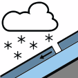
New snow
New snow and wind drift accumulations can release avalanches on all aspects above 2,000 m, with natural avalanches possible as the day progresses.
Bulletin for Monday 23 November from AINEVA · issued Sunday 18:00, valid until Tuesday 01:00
ModerateLevel 2 · above the treeline
Danger
Moderate
Moderate above the treeline, Low below
Slopes
All aspects
Above the treeline
Problems
 Wind slabNew snow
Tomorrow, Tuesday
No forecast given
Written by AI from the official bulletin. Read it in full before you decide.
The Avalanche Warning Service currently has only a small amount of information that has been collected in the field. The wind slabs represent the main danger.
As a consequence of new snow and wind natural avalanches are possible as the day progresses, but they can reach medium size in some cases. Above approximately 2,300 m they can be released in the new snow and wind slab layers.
The wind slabs will be deposited on unfavourable layers. They and to be assessed with care and prudence.
Single backcountry tourers can release avalanches. Adjacent to ridgelines and in gullies and bowls and at the base of rock walls the likelihood of avalanches is higher.
Tuesday 24 November
The risk of spontaneous avalanches will gradually decrease.
New snow and wind drift accumulations can release avalanches on all aspects above 2,000 m, with natural avalanches possible as the day progresses.
Wind-drifted snow deposited on unfavourable layers forms wind slabs that can release naturally or when a single tourer triggers them.
Above approximately 2,000 m there are 20 to 50 cm of snow.
As a consequence of the occasionally strong northwesterly wind, fresh snow drift accumulations formed on Saturday. The snowpack will become in some cases unstable.
Towards its base, the snowpack is moist, in particular below approximately 2,300 m.
At low and intermediate altitudes only a little snow is lying.
Published in English by AINEVA and shown as written; AvaRisk only arranges it. AvaRisk shows this bulletin for information only; always consult official sources and use your own judgement in avalanche terrain.
Official bulletin at AINEVA