Pelvoux avalanche bulletin for Thursday 12 November 2026
Considerable
Above 3000 m
Moderate
Below 3000 m
Rising during the day
Steep slopes facing All aspects
-
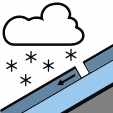 New snow
-
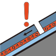 Persistent weak layer
Summary
Above 3000 m danger level 2 (Moderate) rising to level 3 (Considerable), and lower down danger level 2 (Moderate).
Continue reading →Key messages
- Danger level 3 (Considerable) above 3000 m, level 2 (Moderate) below.
- Wind slabs are forming above 2800 to 3000 m on all aspects and are easily triggered, especially on west, north and east-facing slopes.
- Heavy snowfall is expected above 2800 to 3000 m; avoid steep terrain and loaded gullies at high altitude.
Skier-triggered
Slabs forming at high altitude, under southwesterly winds.
Continue reading →Natural
With the snowfall at high altitude, small to medium-sized natural avalanches.
Continue reading →Tomorrow, Friday
Considerable (3) No change
Danger stays Considerable at high altitude. Weather returns to dry conditions. The slabs formed on Thursday remain sensitive at the highest elevations and on west, north and east-facing slopes.
Continue reading →Snowpack
Snowpack becoming very unstable at high altitude in the core of the massif
Read the full assessment →