
Wind slab
New snow and wind slabs are prone to triggering and can be released by a single winter sport participant, mostly medium-sized.
Bulletin for Monday 23 November from SLF · issued Sunday 18:00, valid until Monday 18:00
ConsiderableLevel 3 · above 2,200 m
Danger
Considerable
Above 2,200 m
Slopes
N, NE, E, SE, W, NW
Above 2,200 m
Problems
Wind slab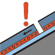 Persistent weak layer
Tomorrow, Tuesday
Considerable
No change
Written by AI from the official bulletin. Read it in full before you decide.
Danger level "considerable" (3-) in west to northeast to southeast facing aspects above 2,200m.
The new snow and wind slabs are prone to triggering. Avalanches can be released, even by a single winter sport participant. In some places avalanches can also be released in the old snowpack. This applies especially on north and east facing slopes above approximately 2,600 m. Mostly avalanches are medium-sized.
Backcountry touring calls for experience in the assessment of avalanche danger.
Tuesday 24 November
ConsiderableNo change
The avalanche situation remains delicate. Dry avalanches can be released by a single winter sport participant, including in deeper layers. Backcountry touring calls for experience in the assessment of avalanche danger.
New snow and wind slabs are prone to triggering and can be released by a single winter sport participant, mostly medium-sized.
In some places avalanches can also be released in the old snowpack, especially on north and east slopes above about 2,600 m.
The snow depths are well below average for the time of year and are scarcely sufficient for snow sports in open terrain. Especially on shady slopes with smooth ground above approximately 2,400 m, there is a cohesive layer of coarse-grained, weak old snow at the snow base. These weak layers are in some places covered with wind drifted snow from the last few days. These wind slabs are prone to triggering.
Published in English by SLF and shown as written; AvaRisk only arranges it. AvaRisk shows this bulletin for information only; always consult official sources and use your own judgement in avalanche terrain. Send an observation to SLF.
Official bulletin at SLF