Wednesday 11 November 2026 Vanoise avalanche bulletin · valid until 18:00 today
Low All elevations
N, NE, NW
-
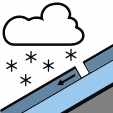 New snow
Low (1) No change
The danger level remains Low (1). Accidental avalanche risk is now limited to rare slabs on high-altitude north-facing slopes, and rain-driven wet avalanches are no longer expected because the snowpack has been largely purged. AI summary comparing the two official bulletins.
Assessment
Updated 8 hours ago
Summary
Danger level 1 (Low).
Key messages
- Danger level 1 (Low) today and tomorrow.
- The main problem is rare, small slabs in fresh snow on high north-facing slopes above 2900 m, which can trigger small avalanches.
- Natural wet avalanches are unlikely, as the rain has largely cleared the snowpack.
AI summary of the official Météo-France bulletin. Always read the full bulletin.
Skier-triggered
Rare slabs still possible on high-altitude north-facing slopes.
Natural
Unlikely
Tomorrow
Thursday 12 November
Low (1) No change
Danger level 1 (Low)
A fairly active new southerly disturbance, again with very mild temperatures and occasional foehn sunny spells. Only the high mountains will see more snow, with a risk of new slabs in the fresh snow.
Snowpack and avalanche problems
New snow
Snowfall (New Snow Problem). Fresh snowfall forming a soft slab on top of existing layers.
Only the high mountains retain a somewhat wintry look
Triggered avalanches
Rare, small slabs in fresh snow on north-facing slopes above 2900 m. Up there the snowpack is starting to build up, having escaped the rain on Tuesday and Wednesday. In this limited area, there are often 20 to 30 cm of still fairly loose snow, to which the few cm due Wednesday will be added. The gaps between blocks and stones are slowly filling, so the slabs are still limited in extent. They lie on a thin weak layer of angular grains dating from late October, which in places may give way under a skier or mountaineer, triggering a small avalanche. Size 1.
Natural avalanches
Rain up to 2900 m has largely cleared and purged the snowpack on Tuesday. On Wednesday the rain will not rise any higher, so it should not trigger new wet avalanches, as there is little snow left to melt.
Snow cover and skiing
Measured 10 Nov 2026
- 1900 m
- Skiable from, north faces
- 2800 m
- Skiable from, south faces
- 0 cm
- Fresh snow in 24 h at 1800 m
Snow depth by elevation (cm)
- North faces
- South faces
Snow quality
Snow cover
Tuesday's rain has melted an already snow-poor snowpack, although the high mountains still have a somewhat wintry look.
Skiable limit
Only on north-facing meadows and glaciers (not too crevassed) above 2400-2500 m. On north slopes there is more snow below 2200, or even 2400 m depending on the location. On south slopes there is almost no snow below about 2800 m.
Snow quality
Wednesday on north slopes: wet to soaked snow due to rain below 2700 m. Crust from 2700 to 2900/3000 m, and powder that is more or less wind-affected above that. During the showers on Wednesday, a light dusting is possible, descending to about 2700 m. On gentler south slopes, there is no snow below 2800 m. Above that, a few cm of fresh snow lie on dense, wet snow.
Weather today
Weakly disturbed and mild, with some showers during the day. Rain-snow limit around 2700 m.
| Time | Sky | Wind 3500 m | Wind 2500 m | Freezing level | Snow line |
|---|---|---|---|---|---|
| 06:00 Wed |
 Cloudy |
40 km/h SW | 15 km/h SW | 3000 m | — |
| 12:00 Wed |
 Showers |
45 km/h W | 20 km/h SW | 3000 m | 2700 m |
| 18:00 Wed |
Showers
|
55 km/h W | 20 km/h W | 2800 m | 2600 m |
| 00:00 Thu |
Cloudy
|
45 km/h SW | 15 km/h S | 2900 m | — |
Cloudy
- Wind 3500 m
- 40 km/h SW
- Wind 2500 m
- 15 km/h SW
- Freezing level
- 3000 m
- Snow line
- —
Showers
- Wind 3500 m
- 45 km/h W
- Wind 2500 m
- 20 km/h SW
- Freezing level
- 3000 m
- Snow line
- 2700 m
Showers
- Wind 3500 m
- 55 km/h W
- Wind 2500 m
- 20 km/h W
- Freezing level
- 2800 m
- Snow line
- 2600 m
Cloudy
- Wind 3500 m
- 45 km/h SW
- Wind 2500 m
- 15 km/h S
- Freezing level
- 2900 m
- Snow line
- —
Last 7 days
Shaded column is the forecast
- 55 km/h
- Strongest wind, from the SE, 3500 m, Wed 4, 12:00
- 2000–3000 m
- Freezing level range
- 5 cm
- Fresh snow over 7 days at 1800 m


About this bulletin
- Issued
- Tuesday 10 November 2026, 16:00 by Météo-France Valid until Wednesday 11 November, 18:00
- Source
- Official bulletin at Météo-France ↗ Fetched from Météo-France's public data API
- Translation
- Translated from French by AvaRisk. Translations can contain errors, so check the official bulletin before you decide.