Alto Moesano.
The daily SLF avalanche bulletin for Alto Moesano, in English, with the season’s snowpack and past bulletins.
What’s under the snow?
One persistent weak layer, likely to persist.
A layer of faceted crystals near the ground has been reported every day on shady slopes. Recent snow has added load without bonding to it.
What to do
- Keep to slopes under 30° on shady aspects and avoid shallow, rocky areas.
AvaRisk’s reading of the season’s bulletins, not part of the official forecast. Outlook confidence: medium.
Is it getting safer?
No. Danger has risen to Considerable over the past week.
- Rising
- 7-day trend
- 5 of 7 days
- at Considerable or above this week
- 9 of 60 days
- at Considerable or above this season
- 1,812 m
- freezing level, latest
Danger by day, last 28 days
Two colours: upper above the elevation split, lower belowRose during the day (shows the peak)
Which slopes have been trouble?
N to NE, most of the season.
How many days each aspect was flagged in the bulletin this season. Stronger colour means more days.
- N41 days
- NE38 days
- NW27 days
- E22 days
- W9 days
- SE6 days
- SW4 days
- S3 days
How did we get here?
The weather and every avalanche problem in the bulletin, day by day since 24 September. Read down a column to see one day. Rain on snow means the rain–snow line reached 1,800 m or higher.
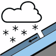 New snow
10 days
 Wind slab
9 days
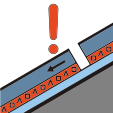 Persistent weak layer
18 days
 Wet snow
0 days
 Gliding snow
0 days
Strong wind506070+ km/hArrows point where the wind blows to
Read the season, not just today.
The story behind today’s bulletin in Alto Moesano, from every bulletin this season.
- Weak layers, tracked through the season
- Whether the danger is easing or building
- Which slopes have been trouble
- Every past bulletin, for every region
Then €2.99 a month, cancel anytime. Card required for the trial.
Already a member? Sign in