Val di Rhêmes.
The daily AINEVA avalanche bulletin for Val di Rhêmes, in English, with the season’s snowpack and past bulletins.
What’s under the snow?
One persistent weak layer, likely to persist.
A layer of faceted crystals near the ground has been reported every day on shady slopes. Recent snow has added load without bonding to it.
What to do
- Keep to slopes under 30° on shady aspects and avoid shallow, rocky areas.
AvaRisk’s reading of the season’s bulletins, not part of the official forecast. Outlook confidence: medium.
Is it getting safer?
No. Danger has risen to Considerable over the past week.
- Rising
- 7-day trend
- 5 of 7 days
- at Considerable or above this week
- 9 of 60 days
- at Considerable or above this season
- 1,812 m
- freezing level, latest
Danger by day, last 28 days
Two colours: upper above the elevation split, lower belowRose during the day (shows the peak)
Which slopes have been trouble?
N to NE, most of the season.
How many days each aspect was flagged in the bulletin this season. Stronger colour means more days.
- N41 days
- NE38 days
- NW27 days
- E22 days
- W9 days
- SE6 days
- SW4 days
- S3 days
How did we get here?
The weather and every avalanche problem in the bulletin, day by day since 24 September. Read down a column to see one day. Rain on snow means the rain–snow line reached 1,800 m or higher.
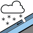 New snow
10 days
 Wind slab
9 days
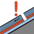 Persistent weak layer
18 days
 Wet snow
0 days
 Gliding snow
0 days
Strong wind506070+ km/hArrows point where the wind blows to
Read the season, not just today.
The story behind today’s bulletin in Val di Rhêmes, from every bulletin this season.
- Weak layers, tracked through the season
- Whether the danger is easing or building
- Which slopes have been trouble
- Every past bulletin, for every region
Then €2.99 a month, cancel anytime. Card required for the trial.
Already a member? Sign in